Friday, October 31, 2014

Thursday Oct 30

6pm : We just arrived at Zavodovski, the northernmost island of the eleven South Sandwich Islands.
After passing Stench Point, we are now anchored  in a less windy bay between Fume Point and Reek Point, at the foot of Mt. Asphyxia, an almost continuously active volcano (we can smell the sulfur in the air even though it is very windy).
Tonight we are expecting 50 knots winds and a big swell, so we will probably move anchorage in the middle of the night to find a more suitable place.
Even though James Cook called these islands “the most horrible Coast in the World”, it is home to two million chinstrap penguins! We hope to see some of them tomorrow – weather permitting.


You can follow the expedition on:


You can also follow the team's position in real time here

Thursday, October 30, 2014

Wednesday Oct 29

After a last quite night in Larsen Bay, a little cove at the Southern end of South Georgia, we left this morning at 5am for the South Sandwich Islands. We’re not sure what to expect. Even our skipper Ben has never been there before. The islands are remote and relatively unknown. We have been told that at the most there is only one boat a year going there. We should arrive tomorrow night.

Last night in Larsen Bay, South Georgia: we used sonar and GPS equipment recently acquired by Australis, our ship (orange pole at back of Zodiac). We surveyed the bay for best possible anchorage. The zodiac criss crosses the bay for an hour collected data allowing the system to provide depth and GPS coordinates which can then be plotted on a screen. See also 3D map picture on our on board monitor. This helps define best location for anchorage as these waters are poorly charted, if at all. The system also gives an idea of the underwater terrain (mud, rocks, etc.).
Zoe took snow samples in the bay. She went up on the hill to avoid ‘pollution’ from the few Weddell seals inhabiting the bay.

 Magnus, our first mate from New Zealand, operates the zodiac and sonar/GPS system.

                                The ReefMaster sonar/GPS/plotting system used in our survey.

You can follow the expedition on:

- Youtube

- Twitter

- Facebook

- Pax Arctica's website

You can also follow the team's position in real time here

Wednesday, October 29, 2014

Tuesday Oct 28

On our way to the South Sandwich Islands today, we stopped at St Andrews Bay (South Georgia) and found
around 300,000 king penguins plus a guy disguised in black to mix with the crowd ;)


 You can follow the expedition on:


You can also follow the team's position in real time here

Monday, October 27, 2014

Monday Oct 27

We are still on the boat in Possession Bay right in front of the glacier.
It continues to be very windy (30-40 knots at sea level, gusting 50+) and it seems worst in altitude so we are waiting for now.
If the weather calms down a bit, we are ready to go up to our former camp and retrieve our equipment.
If that is accomplished, our plan would be to leave early tomorrow morning Tuesday to resume our traverse of the island.
More news soon.

Oct 27 – 11:14am
Wind clocking at 55 knots! No improvement in sight. Abandoning plans of going in the mountains today.

You can follow the expedition on:

- Youtube

- Twitter

- Facebook

- Pax Arctica's website

You can also follow the team's position in real time here

Saturday Oct 25

We arrived last night in Grytviken, the largest town on South Georgia (population 20, mostly scientists and government ;)). Unable to stay in the mountains because of the current weather conditions, we decided to go to Grytviken where we obliged to officially register with the local government.

Our plan now is to leave from here by boat tomorrow (Sunday) and go back to Possession Bay were we will arrive in the evening. On Monday, we plan to go back up the abandoned camp with small snow shovels to recover our equipment which is probably buried under snow (we have the GPS coordinates of the camp so we can find it again). We will get our pulkas ready for an early departure from camp on Tuesday morning.

Today we visited Grytviken, essentially a collection of rusted old industrial buildings and shipwrecks: Grytviken was a whaling station between 1904 and 1964. Originally we planned to visit Ernest Shackleton’s grave at the end of our adventure but fate had it otherwise. Since we were already in the town, we spent time today in the tiny church cemetery where his grave is located.

Our team of nine in the attached photo on Shackleton’s grave”.

 Arriving in Grytviken last night

 Fur seals, mom and pup – Grytviken

 Fur seal – Grytviken

 King penguins in Grytviken

You can follow the expedition on:

- Youtube

- Twitter

- Facebook

- Pax Arctica's website

You can also follow the team's position in real time here

Sunday, October 26, 2014

Thursday Oct 23

We’re in the kind of situation where when one wakes up, we all wake up and today it’s around 6am. We were so exhausted last night that we slept relatively well. I was woke up suddenly at 11:30pm because there was total silence – wind has stopped blowing.  But  unfortunately there was not much we could do at that time. Around 3am, the unnerving sound of very strong winds blowing against the tarp started again, similar to last night. Quite a bit of snow found its way into the tent. Add that to the humidity in the tent from 9 sleeping bodies and consequently the canvas, my sleeping bag (even on the inside) and everything else is very wet.

Now we must wait. What should we do? Get ready and continue on the traverse itinerary? Go back to King Haakon Bay where the boat is? Go to Possession Bay to find protection and wait for the boat to pick us up? We know that the weather forecast is not so good but we are still hoping for a few hours of calm to dismantle the tent and move forward. At our scheduled satellite phone call with Ben Wallis, the boat captain, we discuss the idea of moving the boat to Possession Bay. It will take them about ten hours but it will be a good safety for us if all hell breaks lose with the weather.

We spend the next three hours or so just waiting. Everyone is calm but we can tell from all of our faces – from the most experienced (Ben) to the rookie (Keith) – that we are all nervous and anxious. And all the while the tent is getting smaller because the wind has been pushing snow around the perimeter. It gets harder and harder fit all nine in the tent just sitting. Left to continue the tent will eventually be buried by snow. We know that we have to make some decisions, soon. At some point I look at David and say: ‘In some ways our situation is similar to a Shackleton one: our goal should not necessarily be to finish the crossing of the island but to all return to safety as soon as possible’.

At 10 am we send an urgent SMS to Yan, our weather forecast analyst in France using our inReach GPS/communication device. He works for Meteo France. Using all the data at his disposal, he can give us a precise forecast for the next day or two. Within an hour we get an answer. The forecast calls for more 50-100km/h winds all day. There seems to be no chance of this ending soon so at 11:30am we decide to try to put an end to this misery. We will each carry only a backpack, no skis, no sleds. And we will attempt to go down to Possession Bay. By 12 noon we are all packed and ready to go. The visibility is relatively good, but the wind is extreme. We hope that by the time we reach lower altitudes it will calm down. After almost three hours of descent, sometimes with only 50 feet visibility, we cross a beautiful glacier and finally make it to the beach area. From there we communicate again with Ben Wallis who should be arriving in Possession Bay around 6pm. We are fine but exhausted and now have to wait a couple of hours for the boat to arrive so we spend time ‘on the beach’ photographing seals and birds.

When we finally get on board AUSTRALIS, Ben Wallis tells us that he had 50 knots wind at sea level in King Haakon Bay where he was waiting for us. The crew was very anxious for us as they had no news for the entire night.

Our plan now is to wait for a window of good weather to go up again and resume the crossing from our abandoned camp.

You can follow the expedition on:

- Youtube

- Twitter

- Facebook

- Pax Arctica's website

You can also follow the team's position in real time here

Friday, October 24, 2014

Wednesday Oct 22

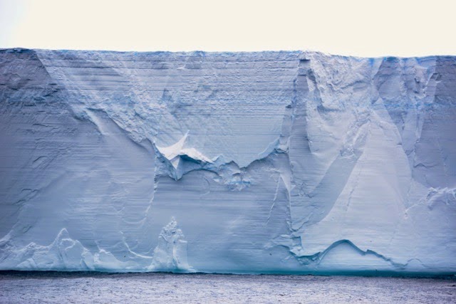
We have been anchored in King Haakon Bay (south west corner of South Georgia) for a few hours. This is the bay in which Shackleton’s wooden boat the James Caird landed on April 19, 1916.
 [Historical note: May 10, 1916: After 17 days in stormy seas, and with superior navigation by Endurance Captain Frank Worsley, the Caird miraculously arrives on the west coast of South Georgia.  May 19: Shackleton, Worsley, and Second Officer Tom Crean set off to cross the previously unexplored interior of South Georgia, heading toward the East coast’s whaling stations. The other three men remain behind.]

The team landed on the beach by 9am with all our gear.  We immediately loaded our sleds and backpacks and were ready to go by 9:40.

The visibility is good but a bit windy.
We leave our skis on our sleds as the first part of the climb is rock and packed snow. We aim for the Shackleton pass, a gentle slope of 300m alt. that we reach by noon. Up there it is very windy, probably 25 knots. The visibility is good and we have a very nice view of Possession Bay on the northern side of the island. We decide to push forward to our planned next camp that we should reach by 4-5 pm tonight.

The wind is getting stronger and almost directly in our face, slowing us down tremendously. It becomes more and more difficult to progress: at 2pm we decide to continue forward for another hour but are ready to turn and head back to Haakon Bay if needed (it would be easier because it is mostly downhill, although it is not easy to go downhill when you are pulling a sled behind you). After 30’, we realize that to continue would be very difficult, risky and dangerous. So we decide to set up camp for the night.  We need to build snow walls, sawing blocks of snow from the ground which is a very long and tiring proposition. We decide to use only our ‘tipi’ tent because it is easier and safer if something should happen and all nine of us can fit inside. The bad news is that it is very windy with no sign of calming down (gusting 50 knots = 100km/h). The (relatively) good news is that we are less than 2km away from Possession Bay where  we could go in the worst case, and wait for the boat to come around the island to rescue us.

It takes a couple of hours to get everything organized and in the tent. By 6pm we are all safely inside and start to prepare for food. Bertrand (our cameraman) is also our head snow melter and food preparer. At some point while cutting cheese he nips his finger and blood starts dripping on the white snow; annoying but not too serious. Geraldine prepares a first aid bandage and after 15’ minutes he is ready to cook again! After dinner all nine of us settle into our sleeping bags. (We definitely could not fit a tenth person in here!) The wind is constantly blowing: 30-50 knots and the noise of the tent canvas flapping at high speed makes for a very hard night.

On King Haakon Bay ‘beach’, South Georgia. I landed first to be able to take some photos.
A welcoming elephant seal.

Our team on King Haakon Bay ‘beach', ready to climb up the Shackleton Pass.

A pause in the storm after the Shackleton’s Pass.

You can follow the expedition on:

- Youtube

- Twitter

- Facebook

- Pax Arctica's website

You can also follow the team's position in real time here

Wednesday, October 22, 2014

Tuesday Oct 21

6:05 pm: We are in sight of South Georgia Island, we should be there in the early hours of the morning, about 3am (it is actually beginning of the day at that hour at that latitude). There seems to be a window of relatively good weather (i.e., winds of 30km/h and snow showers) for the next two and a half days. So we will try to get started early to do most of the island crossing before the bad weather kicks in (100km/h winds, 50cm of snow, etc.). The last part of the crossing is ‘easier’ so we can always camp somewhere and sit out the storm. We will make final decision tomorrow morning in light of what we see on site and the latest weather forecast.
We plan on traveling as a group of nine, four British roped together and five French/Swiss together. This is not a competition, so there is no group trying to go faster than the other. We are all one team inspired by the unlikely exploit of Shackleton and his men a hundred years ago.  To Endurance!

You can follow the expedition on:

- Youtube

- Twitter

- Facebook

- Pax Arctica's website

You can also follow the team's position in real time here

Monday, October 20, 2014

Monday Oct 20, 2014

This morning Ben Wallis, our captain, awakes us at 5:30am, indicating that there is something to be seen on deck: a huge tabular iceberg at the horizon. It must be miles long. As we get closer and pass it we can measure it: 12 miles long by 6.5 miles wide! Probably a piece of Antarctica’s ice shelf which detached a while back and is now caught in the Antarctic and Southern Ocean currents. We figure the top is 50 meters above sea level, so probably a 1/2 kilometer thick iceberg! That is over 100 billion tons of fresh water ice…


You can follow the expedition on:

- Youtube

- Twitter

- Facebook

- Pax Arctica's website

You can also follow the team's position in real time here

Saturday Oct 18, 2014

We are up at 5:30am this morning, to take advantage of the sun coming out, with not so many clouds as yesterday.
We leave anchorage at 6am and go towards Point Wild, where Shackleton’s group of 22 men camped until being rescued four months later.
We arrive at what is left of their ‘beach’ at 10am and go on shore with the zodiac. It is very windy and cold. It is about –17ºC with the wind.
A few chinstrap penguins are onshore, along with a couple of fur seals. One of the fur seals is bleeding from the head: fight or accident?
I shake hand with David, my fellow Explorers Club member. We are thrilled to be here. After a very long start (stuck in Puerto Williams), we are now relatively lucky with the weather. Zoe goes uphill and takes another sample of snow for micronutrients analysis.


You can follow the expedition on:

- Youtube

- Twitter

- Facebook

- Pax Arctica's website

You can also follow the team's position in real time here

Friday Oct 17, 2014 Afternoon

We arrive at Elephant Island. The first sight is impressive, but more so because of everything we have read and heard about it… steep icy rock cliffs hidden in the haze reveal themselves as we approach. We decide to go to the southern part of the island as it is already mid afternoon. This is where we will anchor for the night. We will then try to go to Point Wild tomorrow: this is where Shackleton and five of his men left from on the James Caird lifeboat with the hope of reaching South Georgia.
At 4pm we reach point Lookout, our anchorage for the night. We get a zodiac out and we go onshore. There we are (sort of) welcomed by a colony of several hundreds gentoo penguins and several fur seals. Zoe takes samples of snow in a virgin slope (these samples are then brought back to her lab in France for micro nutriments analysis). We film all this and then Bertrand (cameraman) goes with Geraldine up the glacier for a test snowboard ride. When all done we return to the warmth of the Australis.

You can follow the expedition on:

- Youtube

- Twitter

- Facebook

- Pax Arctica's website

You can also follow the team's position in real time here

Friday, October 17, 2014

Friday Oct 17, 2014

We continue on our way to Elephant Island. All is well on board. Outside the weather is hazy and chilly but relatively quiet.

At 11am, our first alert... Whales: three humpback whales. We slowed down to observe, enjoy and photograph/film. Every once in a while they come up to the surface to breathe and show their magnificent tails.  Orange stuff also come to the surface – it’s  whale pooh! The orange color is due to all the krill they’re eating.

At 1:55pm, another alert…. Iceberg: a large one, approx. 100m long at sea level.  A couple dozen Chinstrap Penguins enjoy the slopes of the iceberg and many are swimming around in the water.

At 3pm, we see Elephant Island for the first time. Actually what we see through the thick haze is just a shadow in the distance.

For more information about Elephant Island click HERE
You can follow the expedition on:

- Youtube

- Twitter

- Facebook

- Pax Arctica's website

You can also follow the team's position in real time here

Thursday Oct 16, 2014

We are on our way to Elephant Island. We are scheduled to arrive there tomorrow afternoon. Not sure yet what we will find there as we have received reports from the government of South Georgia Island that there is a lot of ice around Elephant and the South Sandwich Islands this year. This would not necessarily mean that we cannot land but it would make things more complicated.  If at all possible, we will use zodiacs to reach the ice and then walk.  More on this subject tomorrow night.
Yesterday was definitely the worst day at sea. At Cape Horn and in the middle of the Drake passage there was a constant 40 knot wind and a 6-10’ swell which was enough to impact almost everyone on board. Water was constantly flowing over the boat’s bridge. We tried every brand of pills and devices to combat sea sickness but the majority of us rested horizontal for most of the day, surprisingly asleep! Only the crew and Ben seemed to be impervious to the choppy seas.
Today is much calmer with winds of only 10 knots. We are all getting up slowly.  Same for the albatross that were flying everywhere around us yesterday. Today they are probably relaxing somewhere too since there is much less wind.

Passing Cape Horn, at night, Oct 15 40 knot wind and 10' waves.
 
 For more information about  Cape Horn click HERE

You can follow the expedition on:

- Youtube

- Twitter

- Facebook

- Pax Arctica's website

You can also follow the team's position in real time here

Wednesday, October 15, 2014

Finally Leaving

After a few days being stuck in Puerto Williams because of bad weather conditions (video) the team finally left yesterday around 1:45pm local time. The weather conditions are good and they even encountered their first dolphins after sailing for a few hours.
 
 
They are now en route to Elephant Island, next expedition checkpoint.  
 
You can follow the expedition on:

- Youtube

- Twitter

- Facebook

- Pax Arctica's website

You can also follow the team's position in real time here

Monday, October 13, 2014

Puerto Williams

The team is staying in Puerto Williams, Chile for a few days due to bad weather conditions. On the map, the orange is the front coming their way: winds over 50 knots and certainty of huge swells. They should be able to leave Puerto Williams for Elephant Island tomorrow.


The team took advantage of this bad weather to go to Cerro Bandera, a little mountain where they went training for the crossing of South Georgia. Training video available here.


You can follow the expedition on:

- Youtube

- Twitter

- Facebook

- Pax Arctica's website

You can also follow the team's position in real time here

Friday, October 10, 2014

Ready for departure

After two days in Ushuaia, the team left yesterday night at 10pm EDT hoping to reach Port Williams in Chile during the night (after 4-5 hours of sailing). The last two days where very useful to get ready for departure: purchase of food supplies for 5 weeks, science seminar at CADIC part of CONICET (NSF equivalent in Argentina) where Zoe explained what she is going to do in terms of science. A part of the equipment arrived two days late (snowboards, skis and traveling benches for filming, etc.). They just arrived yesterday, just in time for some testing at the local ski station of Cerro Castor.
If all goes well, they will start sailing to Cape Horn today, where they might stay a day or two depending on weather forecast for crossing the Drake passage.

From Zoe:"I did a small seminar at the CADIC CONICET. I presented the work done on the Drake project that took place from 2006 to 2009 (LOCEAN,CNES) and then I explained the scientific interest of the Shackleton expedition: the deployment of 11 buoys that will measure temperature and salinity from 2000 meters to the surface”.


You can follow the expedition on:

- Youtube

- Twitter

- Facebook

- Pax Arctica's website

You can also follow the team's position in real time here